About Decontamination
Decontamination is one of the measures for radiation protection* to remove radioactive materials from the inhabitation areas to promptly decrease impacts on human health and the environment.
*The national government aims at a long-term goal to reduce additional annual dose to 1 mSv or less by comprehensive measures for radiation risk management including not only decontamination, but also monitoring survey, food safety administration, risk communication, etc.
Results and Effects of Decontamination
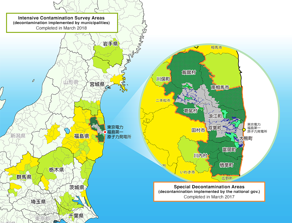
- Municipalities designated as Intensive Contamination Survey Areas
- Municipalities where designation of Special Decontamination Areas or Intensive Contamination Survey Areas has been lifted
- Full-scale decontamination completed in Special Decontamination Areas
- Special Decontamination Areas
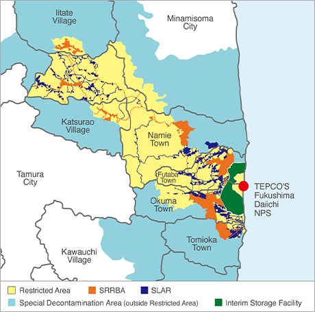
- Restricted Area
- Specified Reconstruction and Revitalization Base Areas
- Specified Living Areas for Returnees
Effects of Decontamination in SDA
<Air dose rate measured at the height of 1m from the ground / Transition according to land category>

NOTE: The chart shows the air dose rate average in each category (aggregated data of measuring points).
Residential areas include schools, parks, cemeteries, and large-sized facilities, farmland includes orchard, and forests include slopes, grassland and lawn.
Post-decontamination monitoring was implemented after 6 months to a year after the decontamination work. The latest result of post decontamination monitoring in municipalities were summarized
[Implementation period]
- Monitoring before decontamination: Nov.2011 - Nov. 2016
- Monitoring after decontamination: Dec. 2011 - Dec. 2017
- Post decontamination monitoring: Oct. 2014 - Aug. 2018
Transition of the Air Dose Rate
7 months post-accident, the region with air dose rates exceeding 0.2 μSv/h within the 80 km radius comprised approximately 96%. However, this percentage dwindled to about 24% at 152months after the accident.
Distribution map showing transition of the air dose rate within 80km radius
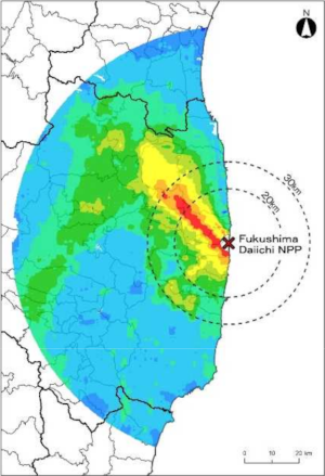
After 7 month from the accident (November 2011)
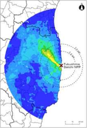
After 152 months from the accident (November 2023)
Result of airborne monitoring in and around Fukushima Prefecture ( NSR / as of March 8, 2019)
Progress of Land Restoration in Temporary Storage Sites (TSS)
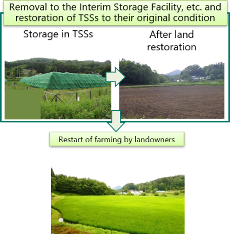
- Temporary Storage Sites (TSSs) from which removal of soil and waste has been completed are restored to their original state based on the previous land use and the plan for the use of the site. Specific methods for the restoration is coordinated with the landowners and municipalities, and the land is returned to the landowner.
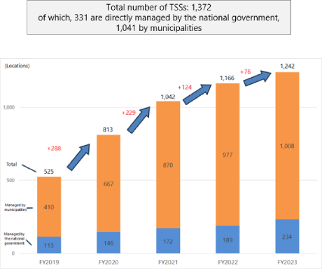
- In FY2023, 76 TSSs were restored, and in total around 90% of the TSSs have been already restored.
Image of removal and land restoration
Cumulative total of the number of Temporary Storage Sites restored to their original condition
Efforts toward lift of the Evacuation Orders
- Full-scale decontamination was completed in all municipalities, except for the Restricted Area, by March 2018.
Restricted Area
Areas with the estimation of an annual radiation dose of more than 50 mSv as of 2011, and off-limits area in principle.
Government policy to lift the evacuation orders in all areas, even if it takes long time, and to achieve the reconstruction and revitalization
Specified Reconstruction and Revitalization Base Areas (SRRBA)
(indicated in orange, designated in FY2017-2018)
- Part of the Restricted Area aiming at lifting the evacuation orders within about five years to allow residents to return
- Decontamination started in December 2017 and evacuation orders were lifted in the Specified Reconstruction and Revitalization Base Areas in all six municipalities by the end of November 2023.
Outside the Specified Reconstruction and Revitalization Base Areas
- An amendment to the Act on Special Measures for the Reconstruction and Revitalization of Fukushima was enacted to allow residents who wish to return to their homes to do so over the course of the 2020s..
Specified Living Areas for Returnees (SLAR)
(indicated in blue)
- A policy was established that allows the mayor of a municipality to create SLAR outside of the SRRBA, with the aim of residents returning to their homes due to the lifting of evacuation orders and rebuilding their lives after their return.
- The SLAR in Okuma and Futaba, which were established in September 2023, began decontamination and the demolition of houses and other buildings in December of the same year (the areas were expanded in February 2024 for Okuma and in April for Futaba, following changes to the SLAR Revitalization Plan).
- In addition, the SLAR in Namie Town, which was established in January 2024, began in June of the same year, and the SLAR in Tomioka Town, which was established in February of the same year, began in September of the same year, and decontamination and the demolition of houses will continue to be carried out steadily.
